When raindrops fall on uninhabited terrain, many things can happen. Precipitation that lands on craggy mountainsides flows downhill to streams. Drops that hit soil often soak in; some of that water later evaporates, while much of the rest seeps through the earth to replenish aquifers and nourish springs. Raindrops that splash into rivers immediately join a headlong tumble toward the sea. Consider, however, raindrops that fall on populated areas. Development brings homes, shopping centers, streets, sidewalks, driveways, parking lots, tennis courts—all of which typically shed water more effectively than the proverbial duck’s back. On the green space that’s left, even small amounts of traffic—tractors, golf carts, lawn mowers, mere human footfalls—can compress the soil and reduce the rate at which it absorbs precipitation.


As an environment becomes inhabited, therefore, less precipitation soaks into the ground and runoff increases. As a result, floods occur more often and develop more rapidly. These hydrological changes, along with the pollutants picked up by water as it pours across the urban landscape, can wreak havoc on aquatic ecosystems and damage habitats alongside waterways.
The relative dearth of water left behind in populated landscapes contributes to the phenomenon of urban heat islands, in which densely populated areas are warmer than the surrounding rural zones (SN: 7/10/04, p. 21: Available to subscribers at City Heat: Urban areas’ warmth affects plant growth). However, scientists suggest that innovative landscaping and architecture could alleviate some of the detrimental effects of this sprawl.
Density’s child
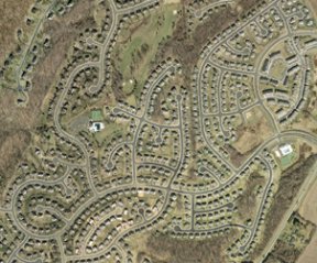
Each year, the population of the United States grows by about 3 million. Construction costs to support that growth exceed $480 billion annually, a substantial portion of which builds about 1 million new single-family homes and more than 10,000 new miles of roads. These impervious surfaces aren’t scattered evenly, however. In suburban areas where homes are built on one-third-acre lots, about 35 percent of the ground is impermeable to precipitation. In densely packed cities such as New York and San Francisco, impervious surfaces may cover more than 90 percent of the ground.
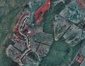
A new analysis of the lower 48 states captures details of the distribution of the nation’s impervious surfaces. The information will be useful to a wide variety of scientists, including hydrologists, ecologists, and water-resource managers, says Christopher D. Elvidge of the National Oceanic and Atmospheric Administration in Boulder, Colo. He and his colleagues used government highway data and satellite images to assemble a first-of-its-kind map on a 1-square-kilometer grid.
Then, the researchers used detailed analyses of 80 high-resolution aerial photos taken in and around 13 urban areas to assign specific values to squares of the map. The results suggest that nationwide, almost 113,000 km2—an area a bit smaller than the state of Ohio—are covered with impervious surfaces. Elvidge and his colleagues describe their findings in the June 15 Eos.
The largest contributors to a region’s impervious-surface area vary with the extent of local development, says Janet S. Tilley, a physical scientist at the U.S. Geological Survey in Reston, Va. In sparsely populated locales, highways account for the largest proportion of impermeable surfaces, she notes. Although many researchers consider pavement to be the biggest source of impervious area in more-developed regions as well, two other factors make major contributions there.
In analyses of satellite and aerial photos of six urban and suburban watersheds scattered across the lower 48 states, Tilley and E. Terrence Slonecker, an environmental scientist at the Environmental Protection Agency in Reston, Va., found that roads accounted for about 28 percent of the impervious areas. Buildings were responsible for around 29 percent of the impervious surfaces, and parking lots made up nearly 25 percent.
Surprisingly, Tilley notes, the research showed that driveways, sidewalks, patios, and pools—features not typically considered in previous research—together made up about 14 percent of those areas’ impermeable surfaces. She and Slonecker presented their findings in the April 1 GIScience and Remote Sensing.
Spillover effects
As the amount of impervious-surface area increases, the environmental consequences become more serious. Previous research has suggested that when the percentage of impermeable surfaces in a watershed is 10 percent or less, streams typically retain good water quality and stable channels. When the proportion is between 10 and 25 percent, storm-fed flows cause noticeable erosion. Major floods tend to widen a stream’s channel, spill over its banks, and scour away waterside vegetation.
Streams in watersheds where more than 25 percent of the surface area is impermeable usually show severe physical and ecological damage.
Because impervious surfaces typically absorb more solar radiation than natural ones do, the water entering streams in urbanized areas can be as much as 6°C warmer than it would be if the area were undeveloped. The stress of that temperature increase, as well as the insult of pollutants swept up from tainted pavement and soil, can kill some aquatic organisms or drive them downstream. Such noxious chemicals can include pesticides, nitrates and phosphates from fertilizers, and salt used to deice roadways.
Parking lots not only make up a large proportion of an urban area’s impervious surfaces but also provide many pollutants to urban runoff. Motor oil and other fluids that leak from parked vehicles find their way into city streams. New research suggests that significant quantities of suspected carcinogens known as polycyclic aromatic hydrocarbons (PAHs) can leach from asphalt-based and coal tar–based sealants used on paved lots.
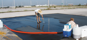
The sealants first came under scrutiny when chemical analyses of sediments collected in 2001 and 2002 from creeks near parking lots in Austin, Texas detected unusually high concentrations of PAHs, says Peter C. Van Metre of the U.S. Geological Survey in Austin. In 2003, he and his colleagues tested the sealants’ impact by running distilled water over 5-by-10-meter areas of sealed and unsealed pavement in local parking lots. The scientists sprayed 100 liters of water over each pavement patch and analyzed the chemicals in dirt swept up by the faux runoff.
Previous research by other scientists detected adverse ecological effects for aquatic organisms when the PAH concentration in sediments reached about 23 milligrams/kilogram, says Van Metre. Material washed from even the unsealed parking lots showed higher concentrations of these contaminants, his team found.
On average, each kilogram of particles from unsealed concrete and asphalt lots contained 54 mg of PAHs. Those substances could have come from vehicle emissions, the smoke and soot from power plants, or material left behind by tires, says Van Metre.
Particles filtered from the runoff from asphalt-sealed parking lots contained 620 mg of PAHs per kilogram, and those from lots treated with coal tar–based sealants held 3.5 grams of PAHs per kilogram of sediment.
Ecological havoc
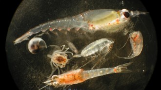
A recent census of the aquatic larvae of mayflies, stoneflies, and caddisflies—key links in a stream’s food chain—showed that the number of species within the three groups dropped in a typical stream as the percentage of urban land in a watershed increased. Those studies, conducted in and around the metropolitan areas of Boston, Chicago, Philadelphia, and Cincinnati, were reported by USGS scientists earlier this year.
The amount of impervious surface that begins to cause ecological damage in streams varies in different areas. In some estuarine ecosystems in South Carolina, water levels fluctuate up to 2 m between high tide and low tide, says Dana Beach, executive director of the South Carolina Coastal Conservation League in Charleston. That constant flushing action masks to some degree the detrimental effects of impervious surfaces. An aquatic ecosystem there doesn’t begin to degrade until impervious surfaces make up 15 percent of its watershed area, Beach has found.
In contrast, studies showed parts of Alaska to be unusually sensitive to damage from pavement. There, the populations of some aquatic invertebrates start to decline when the proportion of impervious surface in a watershed reaches 5 percent, says Steven A. Frenzel, a hydrologist with USGS in Anchorage.
In four streams that flow into and through Anchorage, Frenzel and his colleagues found that sites within the boundaries of an undeveloped military reservation upstream of the city—and therefore not affected by any impervious surfaces—were home to a diversity of insect larvae and other invertebrates. Many of the species found in those waterways don’t survive well if their ecosystem is disrupted. At downstream sites surrounded by areas with impervious surfaces, invertebrate biodiversity was diminished and species known to tolerate some degree of ecosystem disruption, such as sediment-dwelling worms, dominated, Frenzel and his colleagues reported in the July 2003 Hydrobiologia.
No sweat
When a stream’s velocity increases as a result of urban runoff, its channel often carves deeper into the terrain, says Deborah Slawson, a consulting ecologist in Glenville, Pa. In such instances, the rushing water doesn’t spill out among streamside vegetation that would otherwise provide havens for some aquatic life. Many such streams lack shallows where fish can spawn.
Diverting urban runoff through storm drains rather than into streams creates a different set of problems, Slawson adds. If the amount of water that soaks into permeable areas of a watershed and recharges its aquifers is greatly reduced, then the underground supply of water that nourishes streams during dry seasons is diminished as well. In that case, small streams become more susceptible to temperature fluctuations when they receive warm runoff and are less capable of diluting pollutants washed into the waterway.
Increasing the amount of runoff from an urban area influences the local climate. If precipitation doesn’t soak into the urban landscape, it isn’t available to absorb heat, evaporate, and thereby cool the city, explains David J. Sailor of Portland State University in Oregon. By losing its capacity to retain soil moisture, a city, in a sense, loses its capacity to sweat. Other factors contributing to this heat-island effect include heat emitted by industrial activity, gasoline combustion in the city’s automobiles, and the use of utilities such as electricity and natural gas.
Portland creates only a moderate urban heat island, says Sailor. Temperatures in a 2-km2 industrial district near the city’s core, on average, are between 0.5°C and 1.0°C higher than those in areas outside the city.
About 29 percent of that industrial district is now composed of rooftops, and construction on vacant lots there may boost that figure to 57 percent by 2050.
To avoid greatly increasing the temperature, some environmentalists propose a solution consistent with urban development: Buildings could be topped with soil and vegetation, which act as a reservoir for precipitation that would otherwise flow out of the city.
If all the buildings in Portland’s industrial district converted their impervious roofs to so-called ecoroofs, in which vegetation covers at least 75 percent of the rooftop, then daytime temperatures in the district could be as much as 0.5°C cooler than they would be otherwise. Those cooler temperatures could lower the demand for air conditioning in the summer and reduce the adverse health effects that accompany heat waves, Sailor notes.
Ecoroofs are only one of many prospective techniques to avoid the effects of impervious surfaces. Some developers, for example, are digging large, shallow ponds where runoff can collect and seep into aquifers rather than rush into streams and increase erosion.
These approaches may permit further urban and suburban development without exacerbating the problems associated with impervious surfaces.


