No more Superstorm Sandys expected for a long time

Future conditions less likely to steer hurricanes directly into the East Coast

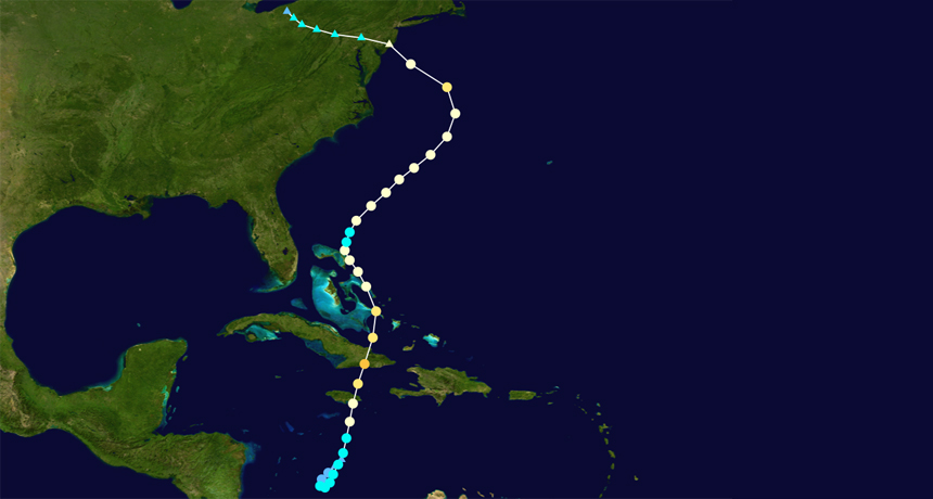
Hurricane Sandy slammed into New Jersey at nearly a right angle. New simulations suggest that the atmospheric conditions that allowed the hurricane to follow its unusual path (shown) will become less frequent in the future.

Cyclonebiskit/Wikipedia

Climate change may bring some good news to the Northeast: The unusual atmospheric circumstances that allowed Hurricane Sandy to slam directly into New Jersey could become even rarer in the future, new simulations predict. Although future conditions may steer more storms away from the East Coast, the new study doesn’t address whether Atlantic hurricanes will change in frequency or intensity.

Most North Atlantic hurricanes travel roughly parallel to the East Coast and make landfall approaching from the south. The October 2012 storm was unusual because it took a left turn and approached from the east, smacking into New Jersey at nearly a right angle. Sandy’s nearly perpendicular angle to the shore intensified its destructive storm surge.

Several atmospheric conditions converged to drive Sandy down its odd path, says Elizabeth Barnes, an atmospheric scientist at Colorado State University in Fort Collins. Kinks in the jet stream, a band of strong air currents, set up a blocking event, which is a high-pressure system that stays stuck in one place for several days to weeks. The blocking event diverted the jet stream south and forced North Atlantic winds to switch direction and blow from east to west. The easterly winds pushed Sandy toward the East Coast; normally, westerly winds guide hurricanes away from North America.

An analysis published in May found that, under current climate conditions, hurricanes like Sandy that hit New Jersey at a right angle occur on average once every 700 years.

To understand how climate change might alter atmospheric patterns and change that frequency, Barnes’ team ran simulations of an extreme warming scenario in which carbon dioxide emissions quadruple over the 21st century. The simulations suggest that the jet stream will shift north and blocking events will become less frequent over the western Atlantic, the researchers report September 2 in the Proceedings of the National Academy of Sciences.

Jennifer Francis, an atmospheric scientist at Rutgers University in New Brunswick, N.J., is not convinced by the findings. She notes that climate models have a tough time simulating blocking events. But Thomas Knutson, a climate scientist at the National Oceanic and Atmospheric Administration’s Geophysical Fluid Dynamics Laboratory in Princeton, N.J., says the results are “suggestive” that wind conditions favoring Sandy-like storms will become less common.

Erin Wayman is the managing editor for print and longform content at Science News. She has a master’s degree in biological anthropology from the University of California, Davis and a master’s degree in science writing from Johns Hopkins University.