Mars’ Gale Crater was probably once a lake fed by rivers roughly 3.5 billion years ago, mission scientists with NASA’s Curiosity rover announced December 8 at a news conference.
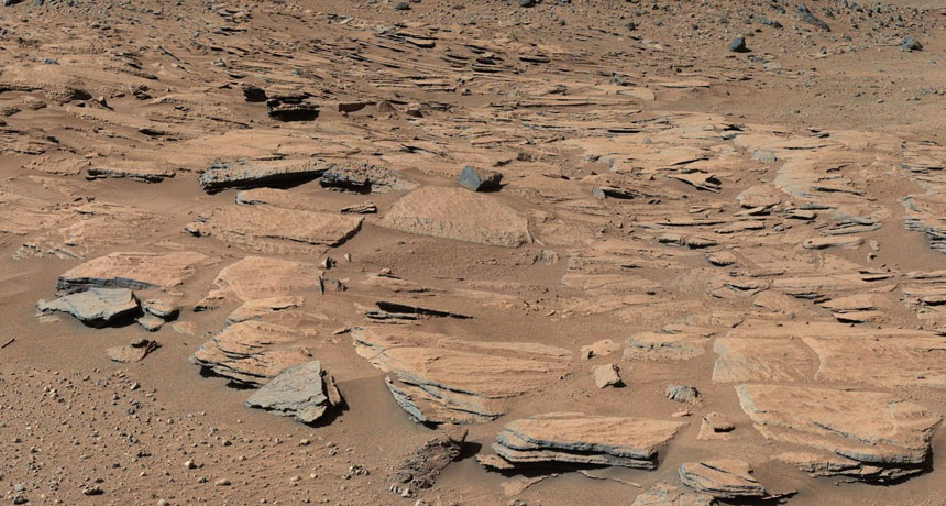
“A lake is not a new idea,” said John Grotzinger, a Caltech planetary scientist. “That’s why the site was selected.” But new images provide the first up-close look at stacked layers of sediment exposed near the base of Mount Sharp, the roughly 5-kilometer-high outcrop at the center of the crater. The slabs resemble similar features on Earth where rivers dump sand and other flotsam as they enter large bodies of water.
The thickness of the deposits indicates they were built over several million years. Curiosity previously determined that the bottom of Gale Crater was once hospitable to microbial life (SN Online: 3/12/13). Figuring out how long those conditions lasted can help determine if Martian life ever stood a chance of thriving.
The new images might also help solve the mystery of how a mountain formed in the middle of the crater. Because all the deposits point toward the mountain, the researchers say, water must have flowed solely from the crater rim. That observation implies that Mount Sharp did not exist when the crater was a lake. Instead, the mountain was probably later sculpted by wind erosion around the crater’s edge.